-

Counterterrorism chief stepping down later this year
Nick Rasmussen will leave the government at the end of this year.
-

Congressmen introduce bills to standardize agencies’ geospatial data
A reintroduced set of bills in the House and Senate would improve the standardization of geospatial data across federal agencies.
-

Navy’s high-tech range support plane will feature advanced telemetry system
Raytheon will develop, fabricate and integrate subsystems with multi-role capabilities to support advanced weapons testing and other missions.
-

A next-gen, precision-guided stealth missile is gaining seeker technology
BAE Systems is adding sensors to the Long Range Anti-Ship Missile, a joint Defense Advanced Research Projects Agency and Office of Naval Research program to develop a semi-autonomous missile able to detect and attack specific high-threat maritime targets within groups of ships.
-

Don’t worry about this battery. It might not need a charge for 10 years.
Researchers are studying a battery for sensors that could run on a charge for 10 years. Some batteries today are replaced every three days.
-
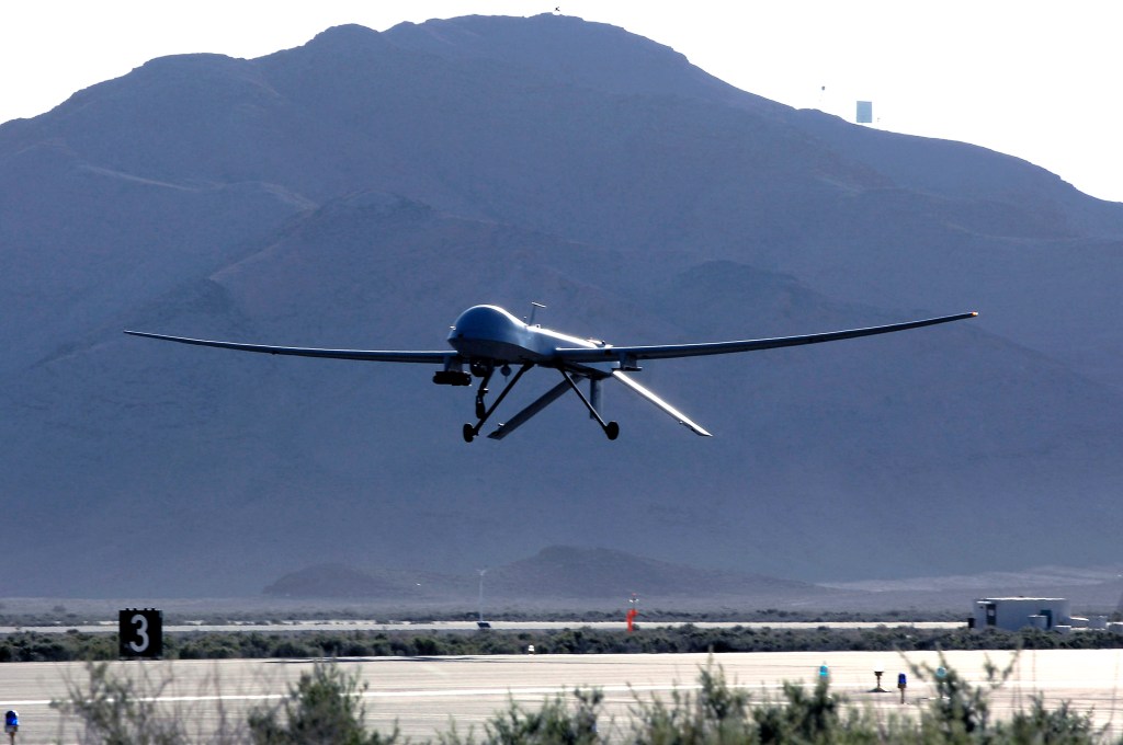
What the NDAA agreement means for C4ISR: More Gray Eagles?
Lawmakers are looking to fill holes in intelligence, surveillance and reconnaissance for combatant commanders around the word in the FY18 National Defense Authorization Act.
-

Satellite imagery offers clues to China’s intentions in Djibouti
China began construction of the base in March last year after it secured of a 10-year lease for what it had said will be a logistics support base used to resupply ships taking part in peacekeeping and humanitarian missions in the Gulf of Aden and Arabian Sea.
-

What World Bank learned from satellite images: ISIS sucked at oil production
It’s a good idea to understand how such a group can harness the resources it commands, and turn them into the fuel for a grotesque war machine. So, for all its bloodshed, how much oil did the Islamic State ultimately produce?
-

Navy’s Triton drone gets a targeting upgrade
Raytheon will leverage its digital sensors architecture to enhance intelligence gathering on the Navy’s maritime surveillance operations.
-

Army CERDEC pushing for next-gen airborne sensor systems
CACI will support the Army’s Communications-Electronics Research, Development, and Engineering Center Flight Activity with airborne platform systems integration, maintenance, and training and operations support for surveillance and reconnaissance.
-
Counterterrorism chief stepping down later this year
Nick Rasmussen will leave the government at the end of this year.
-
Congressmen introduce bills to standardize agencies’ geospatial data
A reintroduced set of bills in the House and Senate would improve the standardization of geospatial data across federal agencies.
-
Navy’s high-tech range support plane will feature advanced telemetry system
Raytheon will develop, fabricate and integrate subsystems with multi-role capabilities to support advanced weapons testing and other missions.
-
A next-gen, precision-guided stealth missile is gaining seeker technology
BAE Systems is adding sensors to the Long Range Anti-Ship Missile, a joint Defense Advanced Research Projects Agency and Office of Naval Research program to develop a semi-autonomous missile able to detect and attack specific high-threat maritime targets within groups of ships.
-
Don’t worry about this battery. It might not need a charge for 10 years.
Researchers are studying a battery for sensors that could run on a charge for 10 years. Some batteries today are replaced every three days.
-
What the NDAA agreement means for C4ISR: More Gray Eagles?
Lawmakers are looking to fill holes in intelligence, surveillance and reconnaissance for combatant commanders around the word in the FY18 National Defense Authorization Act.
-
Satellite imagery offers clues to China’s intentions in Djibouti
China began construction of the base in March last year after it secured of a 10-year lease for what it had said will be a logistics support base used to resupply ships taking part in peacekeeping and humanitarian missions in the Gulf of Aden and Arabian Sea.
-
What World Bank learned from satellite images: ISIS sucked at oil production
It’s a good idea to understand how such a group can harness the resources it commands, and turn them into the fuel for a grotesque war machine. So, for all its bloodshed, how much oil did the Islamic State ultimately produce?
-
Navy’s Triton drone gets a targeting upgrade
Raytheon will leverage its digital sensors architecture to enhance intelligence gathering on the Navy’s maritime surveillance operations.
-
Army CERDEC pushing for next-gen airborne sensor systems
CACI will support the Army’s Communications-Electronics Research, Development, and Engineering Center Flight Activity with airborne platform systems integration, maintenance, and training and operations support for surveillance and reconnaissance.
-
Counterterrorism chief stepping down later this year
Nick Rasmussen will leave the government at the end of this year.
-
Congressmen introduce bills to standardize agencies’ geospatial data
A reintroduced set of bills in the House and Senate would improve the standardization of geospatial data across federal agencies.
-
Navy’s high-tech range support plane will feature advanced telemetry system
Raytheon will develop, fabricate and integrate subsystems with multi-role capabilities to support advanced weapons testing and other missions.
-
A next-gen, precision-guided stealth missile is gaining seeker technology
BAE Systems is adding sensors to the Long Range Anti-Ship Missile, a joint Defense Advanced Research Projects Agency and Office of Naval Research program to develop a semi-autonomous missile able to detect and attack specific high-threat maritime targets within groups of ships.
-
Don’t worry about this battery. It might not need a charge for 10 years.
Researchers are studying a battery for sensors that could run on a charge for 10 years. Some batteries today are replaced every three days.
-
What the NDAA agreement means for C4ISR: More Gray Eagles?
Lawmakers are looking to fill holes in intelligence, surveillance and reconnaissance for combatant commanders around the word in the FY18 National Defense Authorization Act.
-
Satellite imagery offers clues to China’s intentions in Djibouti
China began construction of the base in March last year after it secured of a 10-year lease for what it had said will be a logistics support base used to resupply ships taking part in peacekeeping and humanitarian missions in the Gulf of Aden and Arabian Sea.
-
What World Bank learned from satellite images: ISIS sucked at oil production
It’s a good idea to understand how such a group can harness the resources it commands, and turn them into the fuel for a grotesque war machine. So, for all its bloodshed, how much oil did the Islamic State ultimately produce?
-
Navy’s Triton drone gets a targeting upgrade
Raytheon will leverage its digital sensors architecture to enhance intelligence gathering on the Navy’s maritime surveillance operations.
-
Army CERDEC pushing for next-gen airborne sensor systems
CACI will support the Army’s Communications-Electronics Research, Development, and Engineering Center Flight Activity with airborne platform systems integration, maintenance, and training and operations support for surveillance and reconnaissance.