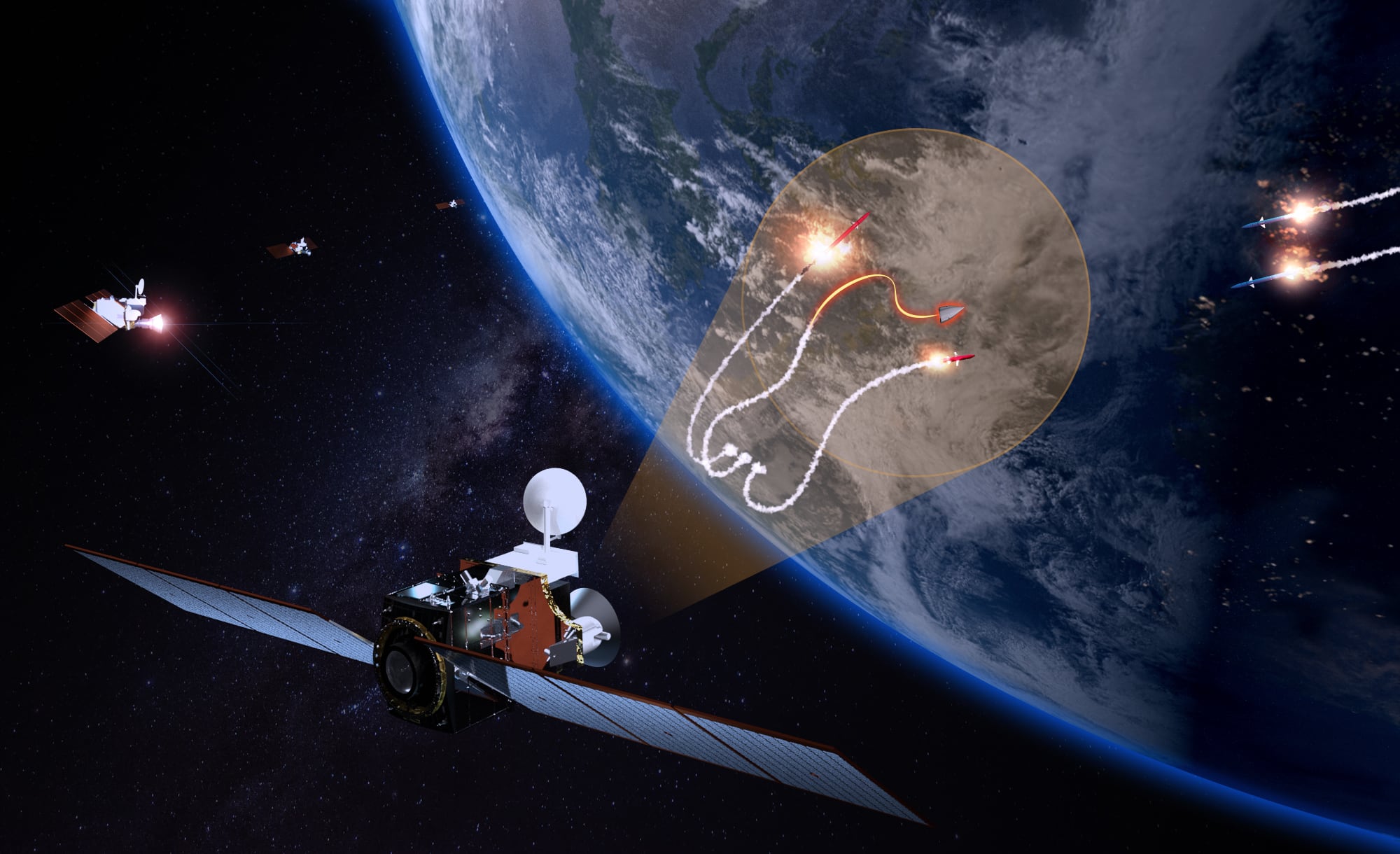
WESTMINSTER, Colorado —Maxar Technologies, a provider imaging and geospatial intelligence services, said the National Oceanic and Atmospheric Administration approved a modification of a remote sensing license to enable non-Earth imaging, or NEI, for its constellation of on-orbit satellites to track objects in space.
Through this new authority, Maxar will collect and distribute images of objects across Low Earth Orbit — the area ranging from 200 to 1,000 kilometers (121 to 621 miles) in altitude — to both government and commercial customers, the company said in a statement.
The ability to provide high-resolution imagery of space objects is more important than ever. There are more than 4,800 active satellites on orbit today, and Euroconsult estimates that 17,000 more will be launched in the next decade. At the same, it is estimated that there are millions of pieces of space debris in LEO, and an impact from even the smallest piece of debris can cause significant damage to a satellite in orbit.
RELATED
“Maxar’s NEI capability has been licensed at a pivotal time for the space industry, when the rapid proliferation of space objects is creating an increasingly crowded Low-Earth Orbital environment, creating new risks for government and commercial missions,” said CEO Dan Jablonsky, in the statement. “Thanks to NOAA’s support and hard work, we are now able to leverage our long-held NEI capability to support critical national security missions, help commercial customers better protect and maintain their assets in orbit and provide a new tool to assist with broader space resiliency initiatives.”
Maxar’s constellation is capable of imaging objects at less than 6 inch resolution at these altitudes, and it can also support tracking of objects across a much wider volume of space. Taken together, these capabilities provide customers with accurate information to assist with mission operations and help address Space Domain Awareness and Space Traffic Management, it said.
NEI can bring more transparency to the near-Earth space domain, thus helping operators better protect and maintain assets. Maxar said it will work with government and commercial customers to utilize NEI in areas including:
— SDA: Helping identify and characterize space objects, as well as assess the operational environment for space operations.
— STM: Supporting on-orbit collision risk assessment and maneuver planning, end-of-life verification and controlled de-orbit collision avoidance.
— Ongoing satellite operations: Assist operators with navigation safety, asset health assessments and defunct satellite monitoring.
—National security missions: Providing support for the U.S. government and its allies.
RELATED
The company said it will begin deploying its NEI capability in 2023 with a select group of early adopters who need to understand and characterize space objects at scale.