WASHINGTON — The Army has awarded Collins Aerospace to build its Mounted Assured Position Navigation and Timing System (MAPS), a program that ensures soldiers know where they are and where they’re going even if the enemy is jamming GPS
“This is a big win for the Army and proof that [Army Futures Command]’s mission to accelerate the development and fielding of modernized Soldier capabilities is working,” said Willie Nelson, director of the Assured Positing, Navigation and Timing (APNT) Cross-Functional Team (CFT). “Less than a year after we equipped the first generation of MAPS in Europe we’re already pushing forward with the development of GEN II. This award comes less than a month after our Mounted APNT requirement was approved. The timing could not be better.”
RELATED

The Phase III Other Transaction Authority contract covers product maturation and begins combat platform integration, clearing the path to low rate initial production.
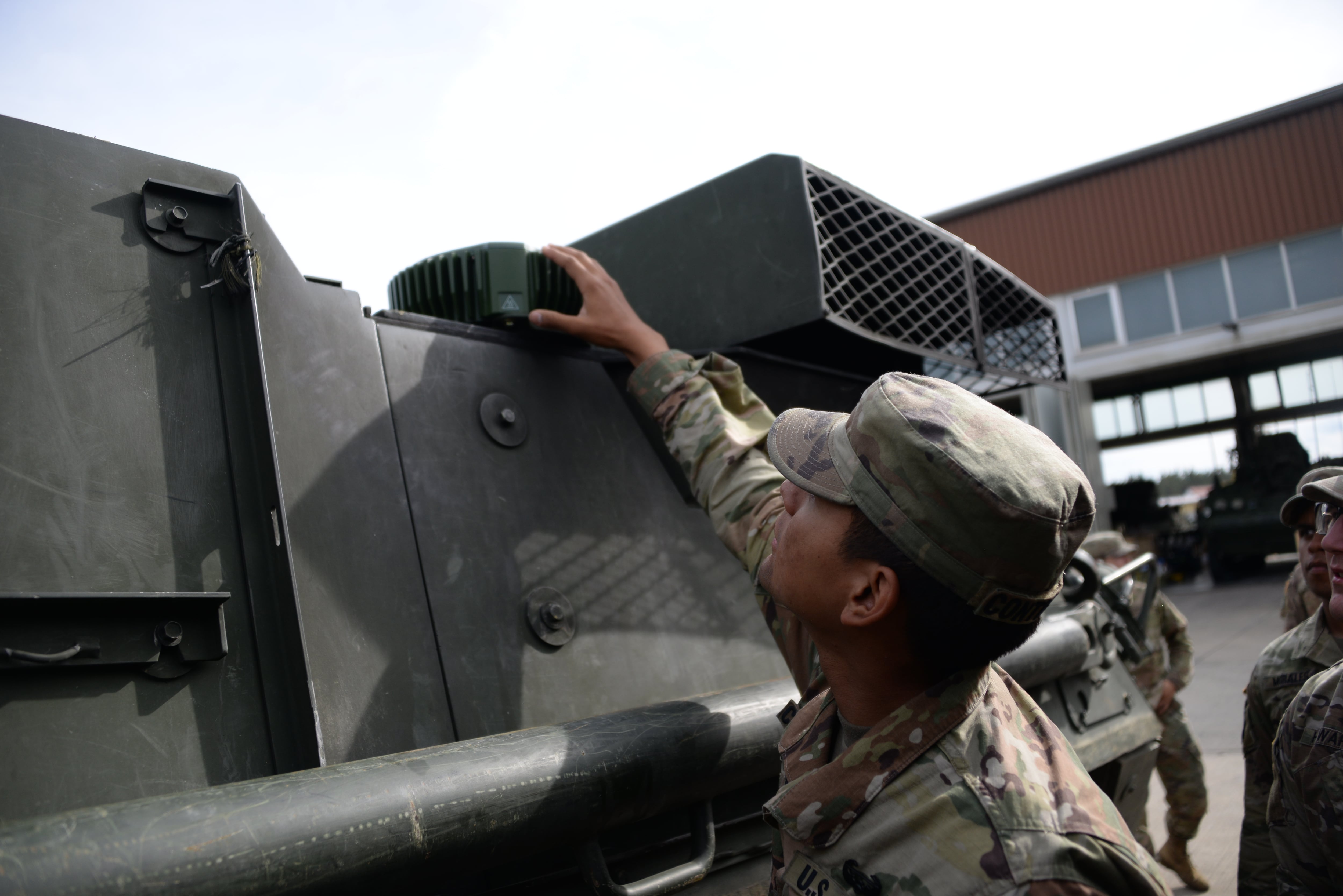
MAPS is an Army technology designed to be installed on vehicles, providing soldiers with accurate position, navigation and timing data even when the GPS signal is denied, degraded or spoofed. MAPS will be able to fuse PNT data from multiple sources, including timing sensors, barometer measurements and inertial navigation units, creating an alternative that can validate, or even replace, GPS data.
Prior to this announcement, two vendors were working on MAPS Gen II. Now, Collins Aerospace will move forward with the program of record.
“Sensor fusion also lays the foundation to operate without GPS or without (radio frequency), because if you can take in velocity or barometer or an (inertial navigation unit), those are not jammable or spoofable. You can know where you’re at and still report where you’re at,” Lt. Col. Alexander Rasmussen, product manager for Mounted Positioning Navigation and Timing, told reporters on a September media call.
MAPS Gen I units have been deployed to soldiers in Europe. In 2019, the Army outfitted Stryker vehicles belonging to the 2nd Cavalry Regiment in Germany with MAPS Gen 1. The Army plans to outfit even more of that regiments vehicles with Gen I units while Gen II is in development. It also plans to install GEN 1 units on Bradley Fighting Vehicles and tanks used by the 1st Infantry Division with the 1st Brigade at Fort Riley, Kansas.
“Soldier Touch Points from the 2nd Cavalry Regiment and 3rd Cavalry Regiment have been a critical component of the MAPS program delivering what Soldiers need,” Rasumussen said in a statement.
While MAPS Gen I represents an initial “Fight Tonight” capability, Gen II will have more advanced features, such as the ability to receive M-Code—a more accurate, jam-resistant GPS code built for military use. It will also feature alternate navigation, anti-jam antenna, sensor fusion, inertial measurement unit, and PNT threat line of bearing.
Following Gen II, MAPS will be incorporated into the C4ISR/EW Modular Open Suite of Standards, or CMOSS. CMOSS is a common chassis the Army is building as part of their new plug-and-play approach to capabilities. Instead of having to install MAPS onto vehicles with each upgrade, CMOSS will allow MAPS to be installed by simply plugging a chip into the chassis. That capability was recently tested out at White Sands Missile Range in New Mexico.
The Army did not release the value of the Collins Aerospace contract.
Nathan Strout covers space, unmanned and intelligence systems for C4ISRNET.