Early Saturday morning, the United States and its European allies launched targeted air strikes against the Assad regime in Syria in retaliation for the Syrian government’s alleged use of chemical weapons.
The satellite imagery companies DigitalGlobe and Planet captured high-resolution images of the strikes, providing the public with a valuable glimpse at the critical information offered by satellites orbiting the globe.
Here’s what the aftermath of the strikes look like from space:
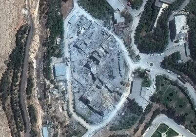
Barzah Research and Development Center
The first strike was aimed at Syria’s Barzah military research and development center, where Pentagon officials said Syrians were producing and testing “chemical and biological warfare technology.” The images below show the three Brazah buildings before and after the coalition air strike.
Use the arrow buttons in the top right corner of the image to toggle from before and after.
Image 0 of 2

Digital Globe captured the images using high-resolution commercial satellites: the WorldView-2 and the WorldView-3. The Worldview-2 captured images before the strikes on April 13, while the WorldView-3 collected images following the strikes, on April 14th and April 15.
Image 0 of 2
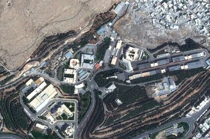
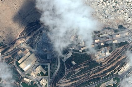
The Barzah research facility was located just north of Damascus. After the coalition air strikes, the Pentagon described the area as “nothing but rubble.”
The image compilation below is of the Barzah air strike location, captured by Planet’s Dove satellites in a sun-synchronous orbit at 11:00 local time in Syria.
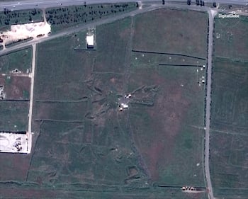
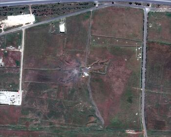
Him Shinshar chemical weapons storage site and bunker
Him Shinshar was the primary sight of Syrian sarin and precursor production equipment, Gen. Dunford said in the press conference at the Pentagon. The following images show two facilities located at Him Shinshar, a chemical weapons storage site and a bunker.
Image 0 of 2
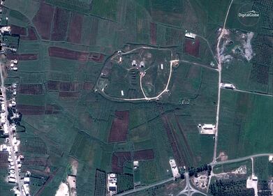
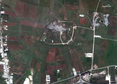
The Him Shinshar chemical weapons facility was located 15 miles west of Homs, a city north of Damascus. The bunker facility was more than 4 miles from the storage site.
Image 0 of 2