YUMA PROVING GROUND, Ariz. — To put it bluntly, the U.S. Army is not exactly known for its space savviness.
However, as the Army gears up for combat with near-peer competitors, it’s doing its best to leverage new space capabilities to improve its targeting and networks, greatly expanding the range it can fire at enemies effectively. And at Project Convergence 20, the service got its first high profile opportunity to show off what it can do with emergent tactical space capabilities.
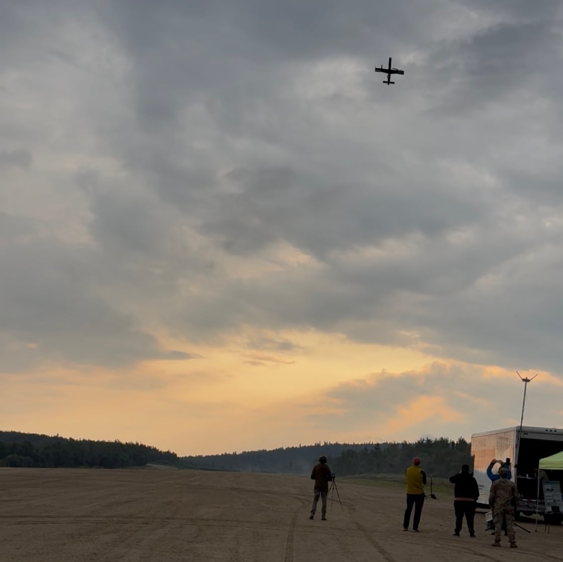
Project Convergence is the first iteration of the Army’s new “campaign of learning,” an effort to bring together the most cutting edge technologies, connect them together with an advanced battlefield network, and extend their ability to hit beyond-line-of-sight targets with confidence. During six weeks in the blazing Arizona heat at Yuma Proving Ground, the Army ran through dozens of scenarios, linking weapons systems and sensors together, applying artificial intelligence to detect and target threats, and using a developmental network to expand the battlefield.
Perhaps most importantly, Army’s Futures Command was able to show how new tactical space capabilities can transform the battlefield.
Three key technologies are driving this change. First are the satellites that can take detailed photos of the battlefield. Second are the developmental ground station and artificial intelligence system that receives those images, processes them, and turns them into targeting data. And third are the tactical communications satellites that take that data and transfer it across the country to the weapon systems that will fire on the target.
RELATED

At Project Convergence, leaders focused on "that ability to request data, bring that data directly back down into theater, very rapidly process that data, you know, finding threats in those images or within that data set,” Willie Nelson, director of Army Futures Command’s Assured Positioning, Navigation and Timing Cross-Functional Team, told C4ISRNET following the exercise.
This transformation is only possible due to the growing prevalence of satellites operating in low Earth orbit.
“For decades now, the military — not just the Army by itself, but the military generally — has been dependent on geosynchronous Earth orbit satellites, or GEO satellites,” a member of the Network Cross Functional Team told Army Sec. Ryan McCarthy in Yuma. “Today, we have commercial satellites in constellations that are at the mid Earth orbit level and the low Earth orbit level, or MEO and LEO. This is a difference between 22,000 miles for the GEO satellites, 5,000 miles altitude for the MEO satellites, and only 320 miles for the LEO satellites.”
Naturally, it’s far cheaper to send a satellite to LEO than to GEO — which has led to an explosion of new small satellites being launched into orbit. Instead of launching five or six massive, expensive satellites into GEO, companies can create huge constellations of small, cheap satellites in LEO to much the same effect. Some of those constellations — think SpaceX’s Starlink and OneWeb - already have hundreds of satellites on orbit.
As those commercial capabilities mature, the Army is keen to leverage them for their own efforts. Instead of using space solely for strategic capabilities, the LEO constellations are opening up a new world of tactical space, on orbit capabilities that can immediately react to and affect what’s happening on the battlefield.
Project Convergence
The APNT CFT got its first real crack at the apple this spring, when they used satellites and a TITAN surrogate for live fire exercises in Germany. A plan to conduct more exercises later in the Pacific was cancelled due to precautions over COVID-19.
However successful that exercise was, and it appeared to go well, it did not have the same level of support and attention as Project Convergence.
“Working very heavily with our mission partners and with commercial providers, we had probably the most robust ... support," said Nelson. "Frankly, I’ve been at this for different types of things for almost 30 years, and I probably would go on the record to say I’ve never seen the interaction and the level of support from our mission partners from across the gamut--You name it, NRO NGA, commercial--like I’ve never seen before. And I think that’s, quite frankly, a testament to the leadership in each of those organizations.”
“I deal with the senior-most folks in those organizations, and they are all so committed to making this tactical space layer work,” he added. “And it’s more than just words, they showed it”
Here is a simplified explanation of the sensor-to-shooter chain used at Project Convergence:
- A satellite take images of the battlefield.
- A TITAN surrogate ground station receives those images.
- There, the Prometheus AI system processes the images, detects threats and transforms it into targeting data.
- The targeting data is sent from TITAN to Yuma via satellite communications.
- At Yuma, the targeting data is populated in the Tactical Assault Kit software.
- The FIRESTORM AI system recommends which fires solution should respond to the threat.
- A human operator approves the recommendation, and targeting data is sent to the weapon system or soldier to respond.
Nelson’s team and their partners were able to run through that chain 350 times during Project Convergence.
“We found the threat rapidly. We were able to identify it as the real threat. We were able to put hit-grade coordinates on it in very near real time, and then digitally send that from the TITAN surrogate unit at Joint Base Lewis McChord in Washington State, down to the firing units that were located down at Yuma via tactical satellite communications. And all of that happened within seconds,” explained Nelson.
“We didn’t get lucky. We didn’t do a trick shot. We got the procedures down,” he added. “We got the tactics, techniques and procedures and CONOPS down. We were actually able to perfect this and get it down to the point where we’re able to repeat that. Again, literally over 350 different mission threads were run over the course of six weeks.”
Here’s a breakdown of each step.

Tactical GEOINT
The whole chain starts in space, where satellites take images of the battlefield.
While Nelson said he was not at liberty to share exactly which satellites were used during the experiments, he said they were able to tap into some national capabilities as well as some commercial constellations over the six weeks.
“What I can tell you is, it was a good teaming aspect in the fact that it wasn’t just government systems,” he said. “And it wasn’t just commercial. It was a blend of both.”
On the commercial side, the Army sees value in leveraging on orbit capabilities that have a commercial sector business that can sustain them, bringing down prices for when the military wants to use them. Nelson pointed to BlackSky, Planet Labs, Maxar’s Worlview, and Hawkeye 360 as examples of companies with LEO GEOINT capabilities that the Army could potentially tap into.
“To some extent, I can say they were involved in some of this testing, and will continue to be more and more involved in our continued campaign of learning,” said Nelson.
TITAN and Prometheus
Once the images were taken, they were downlinked to a Tactical Intelligence Targeting Access Node (TITAN) surrogate located at Joint Base Lewis McChord in Washington State. TITAN is a scalable ground system being developed by the army that will be able to downlink data from multi-domain sensors, fuse it and transform it into targeting data for weapon systems.
The Defense Innovation Unit has tapped Northrop Grumman to build two TITAN prototypes, which will be used for exercises starting in 2022 and 2023. Until then, the Army is using a TITAN surrogate that can essentially perform the same functions in the sensor to shooter chain.
Once TITAN has the images, it uses an artificial intelligence system called Prometheus to process them, detect threats and transform it into targeting data.
RELATED
Army leadership--including McCarthy--admitted that AI applications like Prometheus are still brittle, but they will only grow stronger as they are fed more data.
“I’m very, very pleased with the progress Prometheus is making — proud of the team and what they were able to demonstrate,” Nelson said. “But I think what you’re probably hearing — and it’s a fair comment — is we truly have a ways to go to train algorithms to detect any target, or any threat.”
While it might seem strange to have the TITAN surrogate located hundreds of miles from the action in Yuma, Nelson pointed out that is similar to how it could be used in the future.
“In many cases, you won’t have a TITAN - at least not initially — co-located with every fires battalion in the field," he explained. "And so there will be some degree of centralization of that TITAN data at some echelon, and then you’ll need to push that data either in most likely through SATCOM like we demonstrated — some distance (from) the actual shooters.”
SATCOM and the SDA
So how does the data get from TITAN to the battlefield?
During Project Convergence, the Army was able to use satellite communications to send that targeting data hundreds of miles in just seconds. In some instances, they were even able to use new commercial LEO constellations.
“I don’t want to steal (the Network CFT’s) thunder on this, but I’ll put a plug in for them. So part of the experiment was, we use the traditional MILSATCOM military satellite communications capability to get the data down from Washington to Arizona,” explained Nelson. “But we also had some excursions with some commercial LEO and MEO commercial capabilities. And we’re very impressed with the high bandwidth throughput and low latency that they were able to provide back. We did several excursions with some of those commercial provided satellite communication capabilities.”
A Network CFT official at Yuma specifically noted that they were able to use SpaceX’s Starlink for the experiment. That constellation has approximately 600 satellites available in their constellation, and it will reach persistent global coverage at 4,500.
“Once we get to 4,500 satellites in the next year to two years, we will have global coverage with LEO,” he explained. “Now, LEO satellites being so much closer, severely, dramatically reduces the latency that is inherent in satellite communications. It increases the throughput or transport that we can have for more data. And because of the smaller form factor such as this LEO terminal here and the MEO terminal, we can get more points of presence on the battlefield and closer to the tactical edge.”
While the constellation is still “somewhat immature,” the Army should have more capacity to experiment at Project Convergence 2021, when they expect the commercial constellation to have 24/7 coverage of North America.

The Army experimented with a commercial LEO capability during Project Convergence, but the Department of Defense is developing its own space-based mesh network that will be able to perform the same types of tasks.
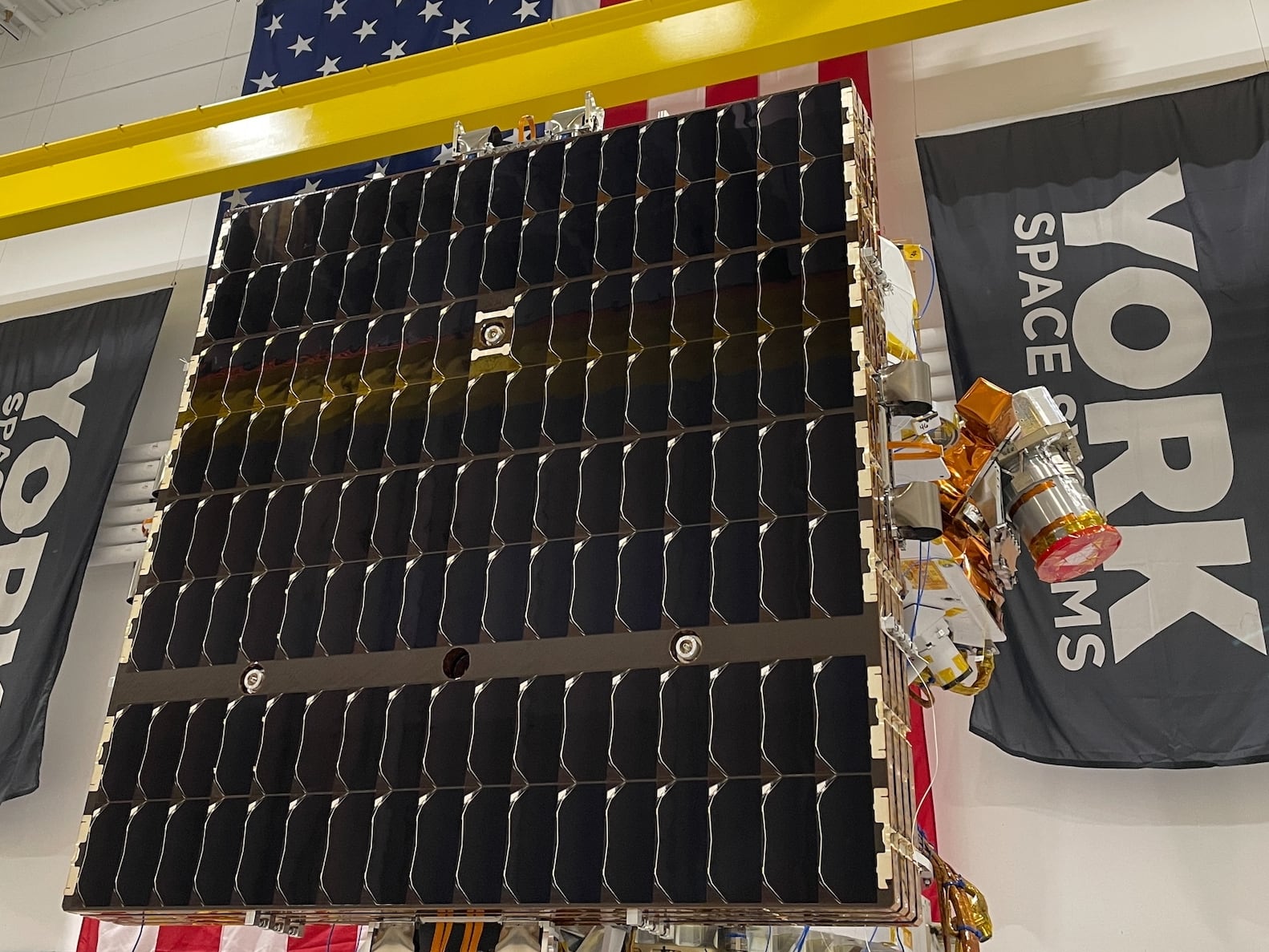
The Space Development Agency was established in 2019 to build the government its own proliferated LEO constellation. It will eventually be made up of hundreds of satellites performing a whole host of tasks, including data transport, detecting and tracking hypersonic weapons, providing beyond-line-of-sight targeting, space domain awareness and much more.
The glue connecting those carrying capabilities is the transport layer--a series of satellites connected by optical intersatellite links to form a space-based mesh network. Like the commercial constellations used during Project Convergence, the transport layer will be able to transport tactical data around the globe in seconds, connecting sensors and shooters at blazing speeds.
Still, the agency does not have any satellites on orbit yet. SDA ordered its inaugural 20 transport layer satellites from York Space Systems and Lockheed Martin in August, with plans for them to be launched into orbit in 2022. The agency will then add more and more satellites with increasing capabilities in two year tranches as part of their spiral development approach--they expect to have hundreds of satellites on orbit in 2026.
“Army Futures Command and (Army Space and Missile Defense Command) are partnered very very closely with SDA,” SDA Director Derek Tournear told C4ISRNET. “We didn’t have any hardware to bring to bear for the Project Convergence demo and test, but we will in the future.”
In the future, the transport layer will be able to route targeting data to the war fighter directly through a Link-16 tactical data link, pass it through a ground station like TITAN, or other solutions being developed by the U.S. Air Force and Navy.
“Our plan is always tied to what the Army is doing, primarily with the TITAN ground system,” he added.
As Tournear has noted previously, the transport layer will be the space-based network component of the Pentagon’s Joint All-Domain Command and Control concept--connecting the services together with satellites.
FIRESTORM and SHOT
The final piece of the chain is another artificial intelligence capability: FIRES Synchronization to Optimize Responses in Multi-Domain Operations, or FIRESTORM.
“What is FIRESTORM? Simply put it’s a computer brain that recommends the best shooter, updates the common operating picture with the current enemy situation, and friendly situation, admissions the effectors that we want to eradicate the enemy on the battlefield,” said Brig. Gen. Ross Coffman, director of Army Futures Command’s Next Generation Combat Vehicle CFT and the lead Army official on the ground for Project Convergence.
Simply put, FIRESTORM can take the targeting data produced by Prometheus, look at the forces available on the battlefield, and recommend the best weapon system to respond to the threat.
Nelson added that the Army is also developing a similar AI capability known by the acronym SHOT. Whereas FIRESTORM is effective in choosing the best weapon for short range fires, SHOT will perform the same task for long range precision fires, he explained.
“What we learned in this experiment was there’s a lot of goodness by both programs,” said Nelson. “And we’re gonna have to look at that and figure out, is it right to have two separate (programs)? Are there enough similarities or enough differences to support two different types of programs, or they should they come together? And that’s far from a decision right now.”
Improving the pipeline
With Prometheus, TITAN, the on orbit sensors and SATCOM, the Army was able to cut down the sensor to shooter timeline from 20 minutes to 20 seconds.
“That’s not an automatic kind of thing. It’s not just a drag and drop--'Hey, you know, I see something here, let me put a hit grid on it and give it to somebody to shoot at it.' That actually takes quite a while in today’s technologies,” said Nelson. “But what we were able to prove is we were able to streamline that and do it digitally.”
But the work is not done.
“So our plan now is to pick up in an FYI 21 campaign of learning--we plan to go back to Europe, again, begin to flesh out these TPPs and CONOPS and get them codified soo these become repeatable capabilities, not just some futuristic experiment,” said Nelson. “And you’ll see some more capability brought to bear at Project Convergence 21.”
Project Converge was an opportunity for the APNT team to nail down the sensor to shooter chain, proving it in harsh conditions with lots of interlocking parts. But it was also a chance for them to demonstrate the value of tactical space to other Army leaders.
“I can tell you with confidence, there isn’t a person in the Army now who doesn’t understand or isn’t able to appreciate the capability that this deep sensing capability from space provides now,” said Nelson. “There’s not a dry eye in the room when you look at how fast we can rapidly find threats and get those to shooters.”
Nathan Strout covers space, unmanned and intelligence systems for C4ISRNET.