On the night of Jan. 29, two dead satellites headed toward each other 560 miles above Pittsburgh. Space is vast, but orbit isn’t, and estimates placed the satellites at no more than 60 feet apart, roughly the length of two full-size school buses, as they passed. In the event of a collision, the blast would leave behind a cloud of debris, a hazardous gauntlet for other geocentric travelers that would threaten for years until gravity cleared the mess.
As details about the size, shape and paths of the satellites emerged, estimates of a collision ranged from 1 in 1,000 to 1 in 20.
Ultimately, these satellites continued harmlessly, a challenge for another day. But the uncertainties in orbit — from incomplete tracking to unknown details about inert military projects — revealed gaps in how military, government and industry leaders calculate risk in space.
What if the current way of predicting satellite collisions is all wrong?
That’s the heart of a new scientific debate, sparked by research from Michael Scott Balch of Alexandria Validation Consulting, who together with co-authors Ryan Martin of North Carolina State University and Scott Ferson of the University of Liverpool, published their findings in Proceedings of the Royal Society A.
The authors contend that existing formulas used to estimate risk and uncertainty in orbit are unable to positively identify safe passage. By relying on these formulas, then, the entire space industry risks collisions that could scatter debris throughout orbit, threatening satellites and the entire utility of space.
“Here is the standard my co-authors and I advocate for each and every conjunction: Prove to me this conjunction will not result in a collision,” said Balch.
In other words, instead of moving when there’s a chance of a collision, operators would have to move to safety unless they could prove there would not be a crash.
If the authors are right, theoretically, satellite operators would have to move objects in orbit every time they could not conclusively prove that there was no risk of collision. And that is an expensive change.
Contrast it with a standard that requires evasive action only if available evidence suggests a collision is otherwise unavoidable. The method proposed by Balch, et al, treats every possible conjunction as a game of chicken played by inanimate objects that will never blink and change course on their own — an inevitable collision unless action is taken.
“Those driving new space ventures seriously misunderstand the challenges with tracking objects in orbit today. Many assume that some governmental body (e.g., the U.S. government) has this all under control and knows exactly what is in orbit, where it is located, and tracks everything continuously,” wrote T.S. Kelso in an email. Kelso is the operations manager for the Space Data Center, which daily screens hundreds of objects in orbit for the risk of collision. “That could not be further from the truth. Making these assumptions can (and does) lead to making bad decisions about methodologies to apply to mitigating risk.”
Cataloging the void
Humans have been putting objects into orbit for over six decades. In 2019, the Satellite Industry Association estimated the value of the global space economy at $360 billion. What matters, for governments and businesses that want to maintain objects in orbit, is getting risk modeling as close to reality as possible. And the problem for space officials is knowing exactly what they want to avoid.
“Whenever another satellite or a piece of debris is going to pass near their asset, satellite navigators use tracking data to determine whether the two objects are actually going to collide,” said Balch. “Theoretically, they should be able to use that information to avoid collisions, assuming they are able to do collision avoidance maneuver whenever the data indicate that they should. But figuring out whether the data indicate that their asset is in serious danger is a task unto itself.”
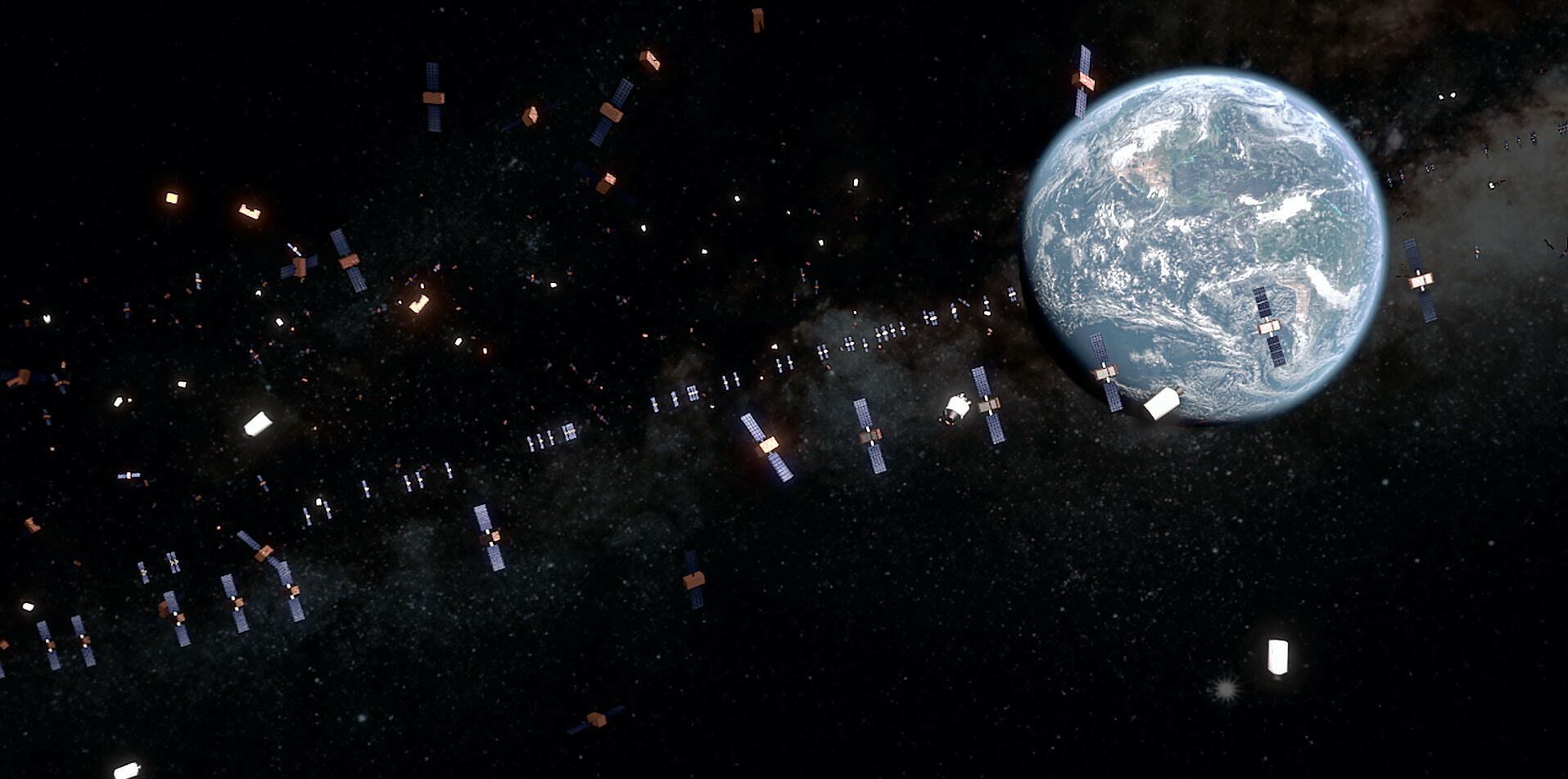
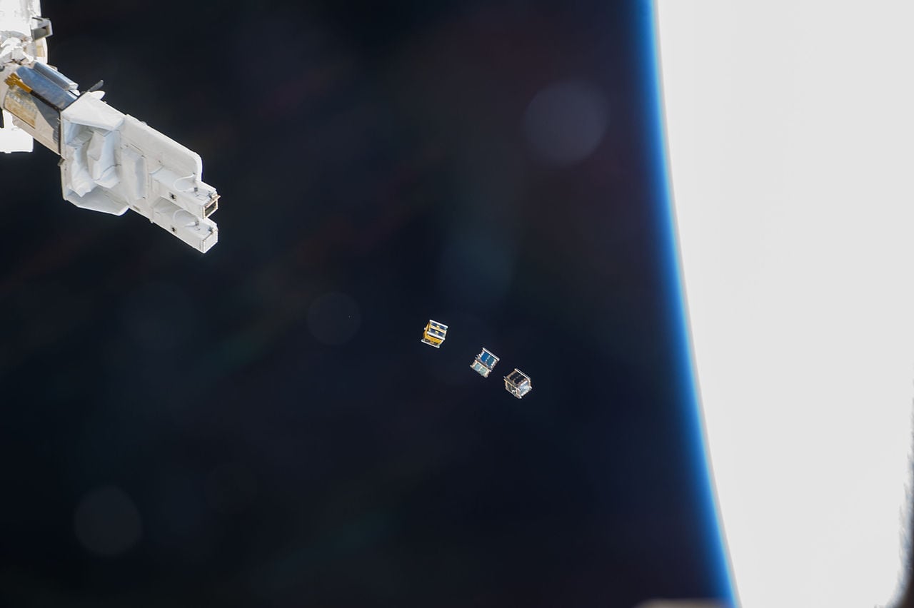
The Union of Concerned Scientists’ database of satellites lists 2,218 in orbit as of September. Everything from loose screws to errant rocks can create a persistent hazard that satellites have to navigate around.
The Aerospace Corporation, which studies debris in space, notes that the threshold for tracking an object is around 2 inches in diameter, or about plum-sized. Anything larger can be tracked, anything smaller is at present hard to see, though new systems promise to change that.
Space Fence, the Air Force’s ground-based radar designed to improve tracking of small debris, began a trial period in late 2019. Its advanced solid-state S-band radar will track objects smaller than 10 centimeters in low- and medium-Earth orbit, greatly expanding the catalog of debris tracked in orbit.
The commercial space industry, too, is looking at increased tracking of debris as an answer to risk in orbit.
“Major satellite operators formed the [Space Data Association] in order to share information about known objects in space and to create a database that all operators could use for space situational awareness to avoid collisions. Despite our best efforts, there is still no central global authority for tracking debris in space to prevent possible collisions," said Jean-Luc Froeliger, vice president of satellite ops and engineering at Intelsat, one of the world’s largest commercial satellite operators. “With awareness of the orbital debris danger growing, hopefully a new global traffic cop for space can be identified.”
But tracking alone is insufficient; objects in orbit do not move perfectly predictably, and while some objects are tracked, not all are. Instead, space planners have to estimate risk, and for this they turn to satellite conjunction analysis.
“If we had better data, there would be conjunctions for which we would know ahead of time that there’s definitely going to be a collision — we’ll call those ‘known dangerous’ conjunctions, but they’re not a practical reality, because the data aren’t nearly precise enough,” said Balch. “That only happens for conjunctions in which both objects are very well-tracked and at least one of them is relatively large. Right now, that describes very few conjunctions.”
In other words, you can only track what you can see.
While close calls like that of Jan. 29 may seem rare, without better tracking and situational awareness in space, we don’t really know what we don’t know in orbit. To better manage the risks of orbit, we might have to start treating that uncertainty as dangerous, instead of safe.
Objects in space
The current method for calculating risk of collision in orbit dates back to 1992 and the Space Shuttle program. It was based, in part, on the limitations of tracking data at the time, and the relative sparseness of objects in orbit. The formula and methods have since been refined, but Balch and his co-authors suggest that there is a flaw at the heart of that reasoning, one which makes it only useful for estimating risk of collision between two well-tracked, large satellites.
One analogy for the uncertainty and probability at play here comes from Matthew D. Hejduk, president of space consulting firm Astrorum. Hejduk offered an example of trying to infer the proximity of two cars, parked in a large parking lot.
“If, however, all we know is that the two cars are each parked somewhere in the lot, then we can also surmise that it is unlikely that they are parked next to each other, but only because in a large parking lot it is extremely unlikely that any two particular cars will happen to be adjacent to each other,” wrote Hejduk. In this case, “the low probability does not mean the data have shown us the two cars are far apart; it is only a statement of the general unlikelihood of such an alignment if all one knows is that two cars happen to be in the same general area — if better information were available about the two cars’ location, we might learn rather easily that the two cars are in fact adjacent.”
As Hejduk framed it, the openness of space is its own kind of safety. Even if objects are likely to be within some distance of each other, they are less likely to be right next to each other.
But the danger at play is that estimating the probability with current methods can often mean planning satellite maneuvers without actually knowing whether there is a real collision to avoid. Even then, maneuvering a satellite comes with real costs, too, which means maneuvers in the face of uncertainty must be balanced against not just the worst-case scenario of orbital collision, but the incidental costs of having a satellite out of routine function.
“Conjunction mitigation actions for satellites, which almost always consist of satellite maneuvers, often exact a significant cost: they spend fuel and thus shorten satellite mission life; they can require considerable human labor to develop, test, verify the safety of, execute, and verify the maneuver; they interrupt the science mission for some period of time during and after the maneuver; and in situations with large uncertainties that would require large maneuvers, a satellite could be displaced from its science orbit for weeks or even months, not taking useful data and, if part of a tandem data collection with another satellite, reducing the utility of that other satellite as well,” said Hejduk. “The direct and indirect costs of mitigation actions are thus substantial, and this must be borne in mind when deciding under which circumstances to pursue mitigation.”
The contention from Balch, that orbital risk remains governed by a flawed model, is a serious claim that warrants a serious response. If it’s correct, it should call into question attempts to fill the sky with new satellite constellations, including both military small sat configurations and larger commercial satellite constellations.
“Just like we perform Environmental Impact Statements for things on the ground, we need to do this for future launches,” Kelso said. “We would want to look at more than just how many collisions might be expected to happen — with the thought that some number of satellites might be lost — but at the risk of major collisions that would harm the overall environment Having a systematic way to perform these assessments would inform policy and law makers of the need for action and help them formulate approaches based on objective data, rather than deciding to take action based on speculation that may not actually help address the problem.”
Small sats are compelling for commercial and military users. Rather than bundling a collection of capabilities into one expensive package, a small sat constellation can disperse the sensors and systems across many small, and individually replaceable, bodies. The Space Development Agency, in particular, is interested in small sats as a way to augment navigation, track threats, and help with early warning. The 2020s are expected to see the most objects launched into space of any decade so far, with some years expected to have more than 1,000 launches.
If the existing math to estimate collision is based on incorrect premises, and the actual risk in orbit is greater than previously understood, then the responsible, if not more even more unlikely, step to take, Balch argues, would be a full moratorium on all new launches.
“Launching thousands of satellites while we're still scrambling to get a grip on collision risk mitigation, that's just asking for trouble. That's the kind of recklessness that engineering disasters are made of,” said Balch.
A moratorium sits at the extreme edge of a range of risk mitigation strategies, all of which require some degree of coordination with the entire international community.
“I don’t think the risk is that great, but even if it was that’s just simply not possible to do. It would mean getting all the space launching countries to agree to not launch any new military or critical science satellites and companies to put all their business plans on hold,” said Brian Weeden, director of program planning for Secure World Foundation. “For better or worse, we are stuck with letting this play out and seeing just how much negative impact there will be.”
Hejduk is skeptical that a full moratorium is the way to go, though he does see utility in the risk formulation advanced by Balch, et al. He suggests that the method they propose be used for conjunctions expected to produce a large amount of debris, and that nations focus on managing risk by actively removing existing debris from orbit.
Kelso, like Weeden and Froeliger, suggests that one path toward better management of collision risk in orbit is moving the role of space traffic monitor away from the military to a civil agency.
“To help the community understand the risk requires increased transparency into how well things work, what kinds of problems occur, and some measure of the overall reliability of the data,” said Kelso. “Unfortunately, most of the data today is produced by military organizations where transparency is counter to their mission (and culture).”
For Balch, while better tracking can reduce the risk of collisions, that tracking needs to be informed by a mathematical approach less comfortable with ambiguity.
“The Air Force has demonstrated that it is willing to put serious money into new orbital tracking resources,” said Balch. “They just don't know what the requirements are because nobody is providing them with a cogent analysis of the problem.”
Debris will only increase as a risk to the stability and utility of objects in orbit. Reducing that risk for the future — while maintaining the vital communications, intelligence and commercial functions of space — may require reassessing the whole risk picture for outer space, and doing so in an environment where nations are increasingly eager to demonstrate new anti-satellite capabilities.
The perils and promise of the next decade in space came into sharp relief Feb. 6, when OneWeb successfully launched 34 satellites into orbit. The launch is part of a planned constellation of 650 satellites, designed to spread internet access across the globe. On Twitter, OneWeb founder and chairman Grey Wyler remarked that the second launch window “came up as red due to a potential collision with another satellite.” He continued, “we didn’t need the 2nd window, but its getting crowded up there!”
It is highly probable that, when it comes to the safety of satellites, no one has had the last word.
Kelsey Atherton blogs about military technology for C4ISRNET, Fifth Domain, Defense News, and Military Times. He previously wrote for Popular Science, and also created, solicited, and edited content for a group blog on political science fiction and international security.