WASHINGTON — The Army’s Intelligence, Surveillance and Reconnaissance Task Force is helping the service modernize its ability to see across huge ranges through a layered approach that includes ground, air and space.
As geographic boundaries will be blurred in future conflict with sophisticated adversaries, the Army is interrogating how it traditionally does everything from imagery collection, signals intelligence and electronic warfare, hoping to transcend current methods and create a battlefield picture that extends across these geographic divisions.
“If you look at how the [National Defense Strategy] describes what we’re supposed to do in competition and conflict, we really needed to have the ability to see deep, to look deep to be able to shape the environment for commanders, [and] the ability to sense the environment,” Lt. Gen. Scott Berrier, the Army’s director for ISR/G-2, told C4ISRNET in an Aug. 18 interview, adding that after the counterterrorism fight, he did not feel as though the Army’s sensors and platforms were in a great place for great power competition.
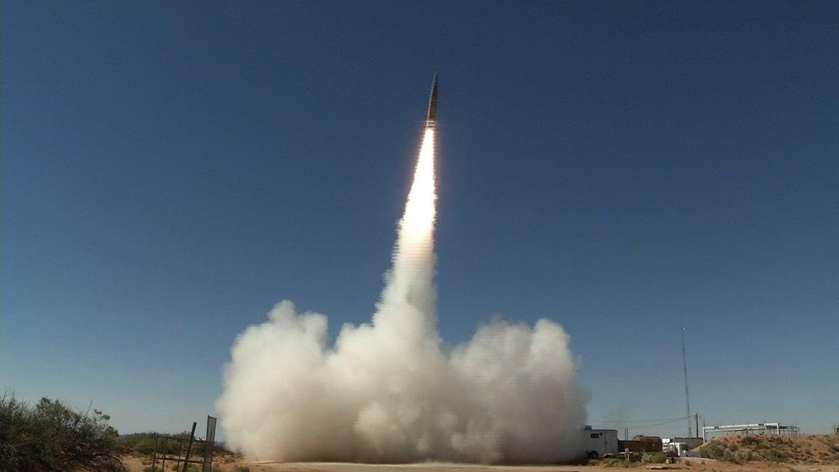
Berrier is departing his post in a few weeks to head the Defense Intelligence Agency, with Maj. Gen. Laura Potter set to pin on a third star and take over as the next G-2 and ISR task force. Under Berrier, the task force has focused on enhancing other Army missions, namely the service’s number one modernization priority: long range precision fires.
RELATED
“We really see ourselves as enabling capability … when you talk about long range precision fires and the sensor to shooter, if you’re going to shoot a target at 1,000 miles, you certainly have to see it,” he said.
The task force works to corral all the ongoing modernization efforts conducted by Army Futures Command and its various cross functional teams, along with the acquisition community, to ensure they are all coordinated for an integrated, modernized ISR footprint. This means helping to advise on and shape requirements for future systems, while contributing in exercises that test new capabilities and concepts with forces across the world.
Other contributors include the Future Vertical Lift and Assured Position, Navigation and Timing teams.
The Task Force is also examining to what extent cyber capabilities can play a role in deep sensing, though details are scarce on this front. The Army’s Program Executive Office Intelligence, Electronic Warfare and Sensors is contributing through offensive cyber, which officials in the past have said cyber is a collection mechanism.
A layered approach
The Army’s ISR modernization approach begins with the terrestrial or ground layer, Berrier said.
The Intelligence Center of Excellence at Fort Huachuca is taking the lead in this arena. The main capability is the forthcoming Terrestrial Layer System-Large, the Army’s first brigade-focused, integrated signals intelligence, electronic warfare and cyber platform.
Berrier explained that the Army is trying to regain capability it lost after the Cold War.
“What we need to have is a sensing platform that can really, really see in the electromagnetic spectrum very complicated signals; to be able to understand [and] perceive the environment; and then — if we want to make an effect inside that environment — [create an effect] with our electronic warfare operators but also ... put an effect into cyberspace,” he said. “We think TLS, with our [brigade combat teams] and those formations, will have what I would call close access, perhaps, to adversary networks. And they’d be able to influence those networks in a number of different ways, as you can imagine.”
The Army awarded two prototypes for TLS — to Boeing subsidiary Digital Receiver Technology, Inc. and Lockheed Martin — for a roughly year long experiment with units, after which it will choose one vendor to move forward.
There are significant changes for the Army in the aerial layer, namely a new, first-of-its-kind jet the Army is experimenting with.
Intelligence and Security Command is heading the aerial layer for the Army currently and just deployed a commercial jet called the Airborne Reconnaissance and Targeting Multi-mission Intelligence System (ARTEMIS), made by Leidos and first reported by Aviation Week, to the Pacific.
ARTEMIS is the first step in something the Army is calling the Multidomain Sensing System, which will operate at higher altitudes than the Army has traditionally operated.
“Our sensors are flying between 22,000 and 24,000 feet today. We think they need to be much higher … think in the 40,000 range,” Berrier said.
He added there is an unmanned component that could potentially include gliders or balloons. However, he acknowledged the technology might not be ready yet.
Ultimately, the Army believes it will need signals intelligence, electronic intelligence, electronic warfare and cyber capabilities in the final Multidomain Sensing System, whatever that ends up being.
Berrier described a year long “campaign of learning” for the Multidomain Sensing System, which begins with ARTEMIS in the Pacific.
“That will take about a year before I think we’re ready to even make a decision. Do we stay sort of in this realm of assets that are around 20,000 feet or 22,000 feet? Or do we, should we go higher to be in that competition ISR fight?” he said, adding the Army will partner with other services on big wing ISR.
Finally, the third layer is the space layer, which manifests itself in the Tactical Intelligence Targeting Access Node (TITAN). TITAN is a ground station the Army is building to replace several existing ground stations.
Since the Army isn’t in the business of building and launching its own satellites, it wants to take advantage of the bevy of satellites already in existence by agencies such as the National Reconnaissance Office. And it believes TITAN will allow it to access these constellations better.
Berrier said there will be some processing and artificial intelligence that goes into the system, enabling it to identify targets sooner.
The Army is experimenting with TITAN “surrogates” in Europe, through the 66th Military Intelligence Brigade, and in the Pacific through the 500th Military Intelligence Brigade.
The Army is also using exercises such as Defender Europe and Defender Pacific along with newer units to include the Multidomain Task Force and its Intelligence, Information, Cyber, Electronic Warfare and Space battalion to help prove out these intelligence concepts and capabilities. It is also working to modernize data standards and dissemination systems such as the Distributed Common Ground System, which is transitioning to the Command Post Computing Environment.
Ultimately, Berrier said these ISR modernization efforts are about helping the Army deter conflict. But if that fails, the service needs to be ready for the multidomain battlefield it expects to fight on in the future against near-peer powers.
“If you do competition effectively and if you do competition ISR in the right way, you’ll never get to conflict because you’ll always have a decision or an information advantage over our adversaries,” he said. “If we do transition to conflict, it is about reducing the sensor-to-shooter loop that’s going to be so key for multidomain operations. If you want to do MDO … the ISR Task Force is about bringing multidomain intelligence to competition and conflict.”
Mark Pomerleau is a reporter for C4ISRNET, covering information warfare and cyberspace.


